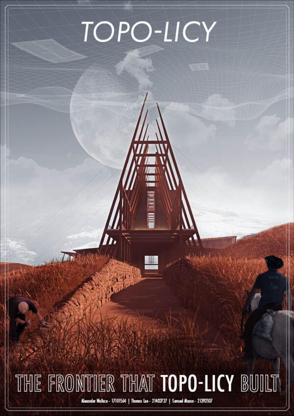
Topo-Licy: The Frontier that Topo-licy built
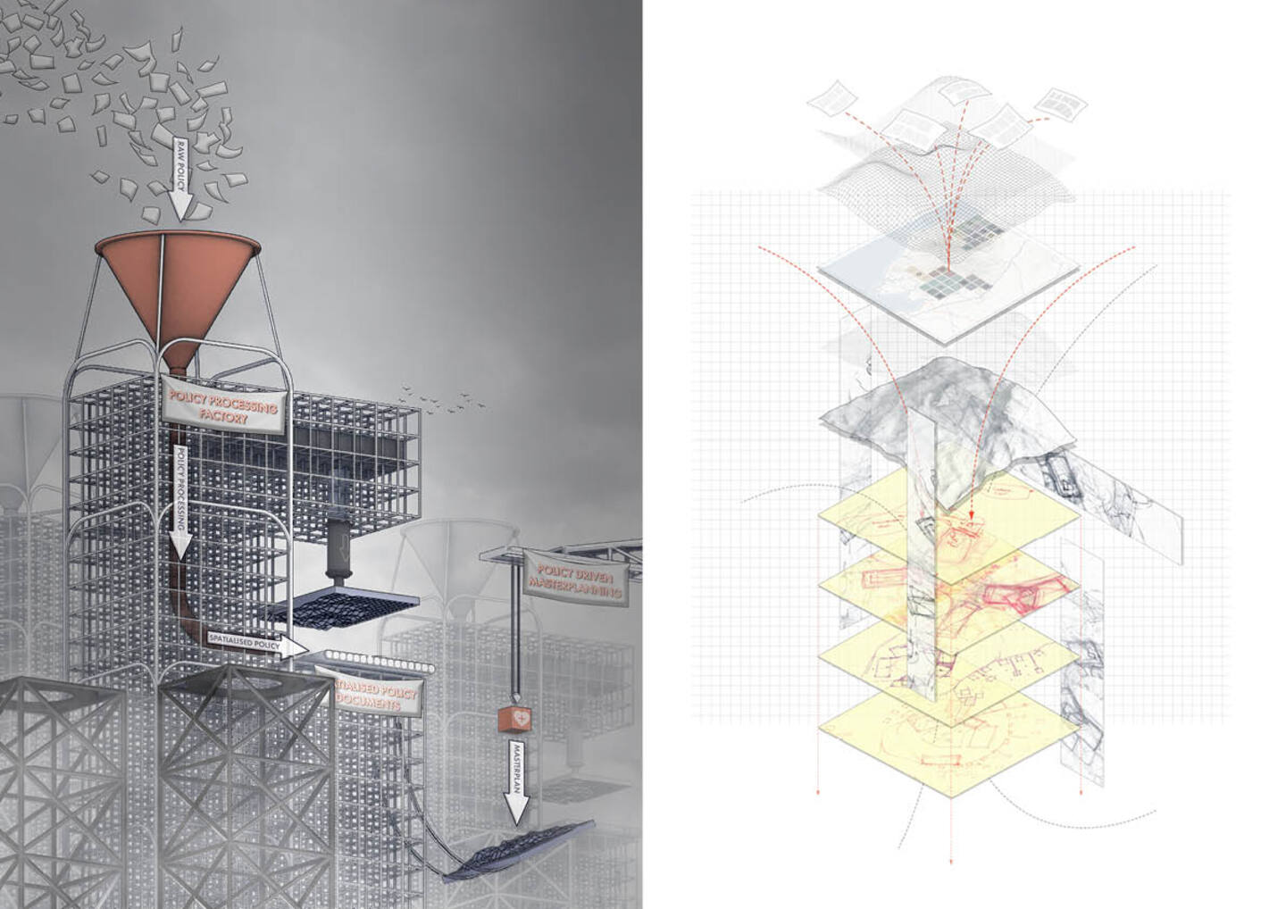
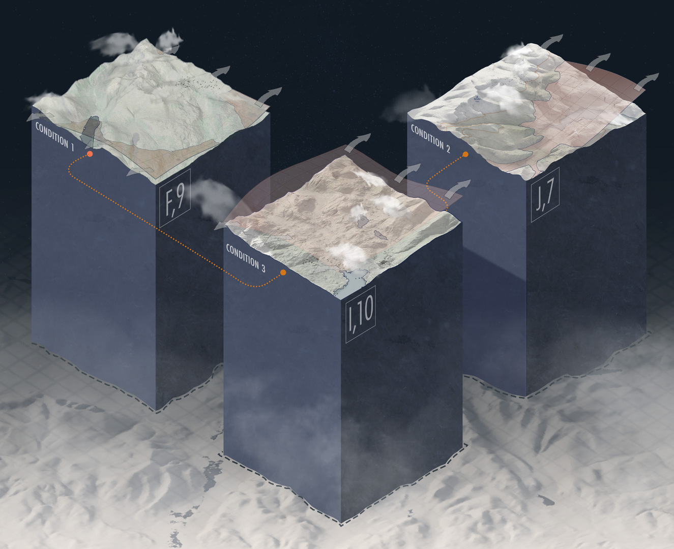
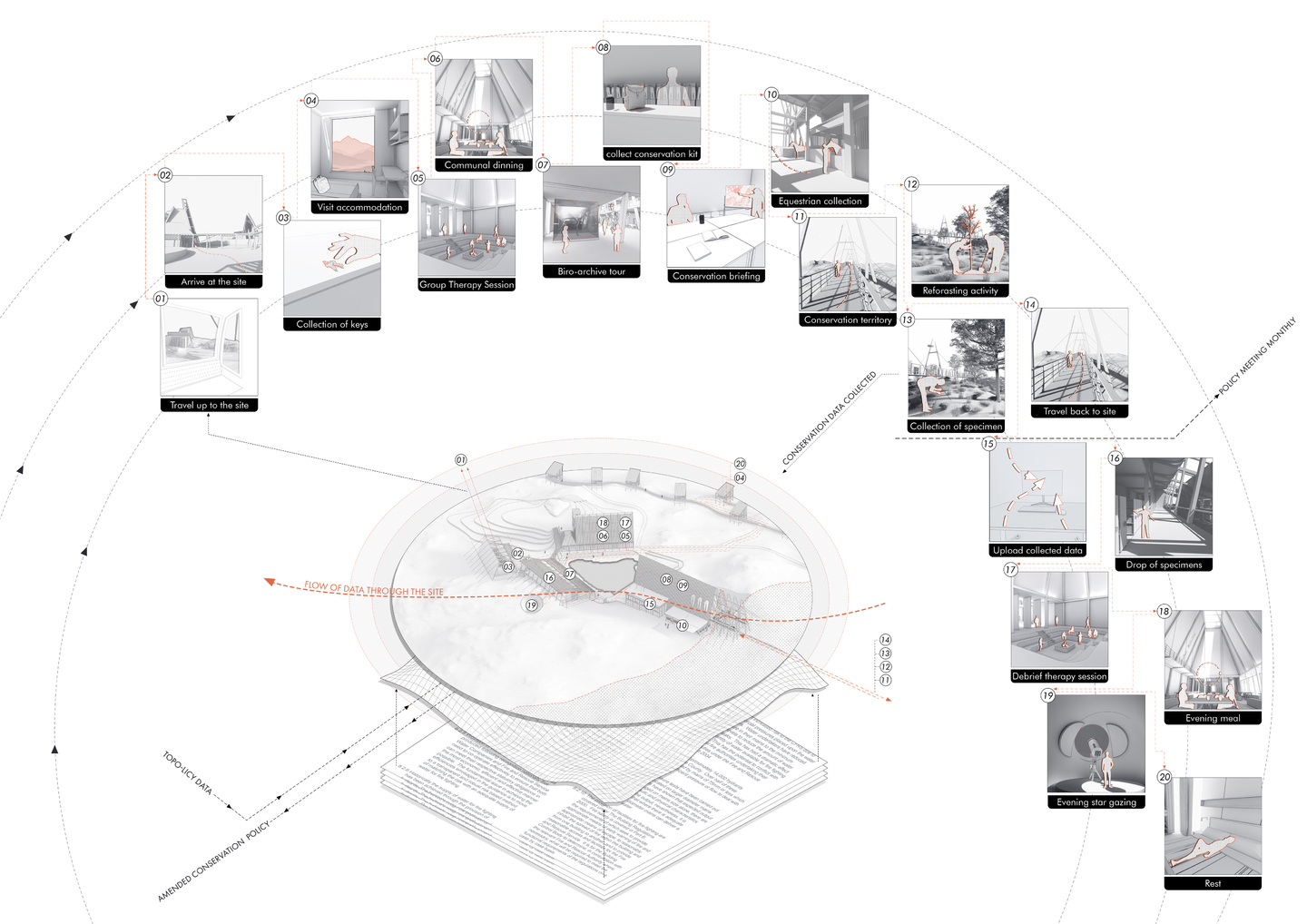
The project aims to create a topological study of policy and the relationship between physical and policy landscapes. Topo-licy is the name of the system we developed through the project to turn policy documents into three-dimensional data with spatial values. Cumbria was the territory to which this was applied, allowing the testing of concepts and develop not only a tool for policy representation but a live and interactable policy format.
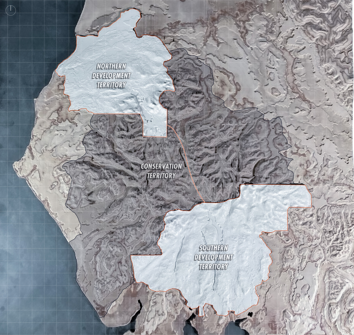
Using this new spatialised policy data set, a masterplanning tool was developed to extract the formatted data and produce a policy driven masterplan. This was tested and explored through the project using a speculative design model of research and theorised that a conservation and development territory could be proposed to allow policy to become more productive.
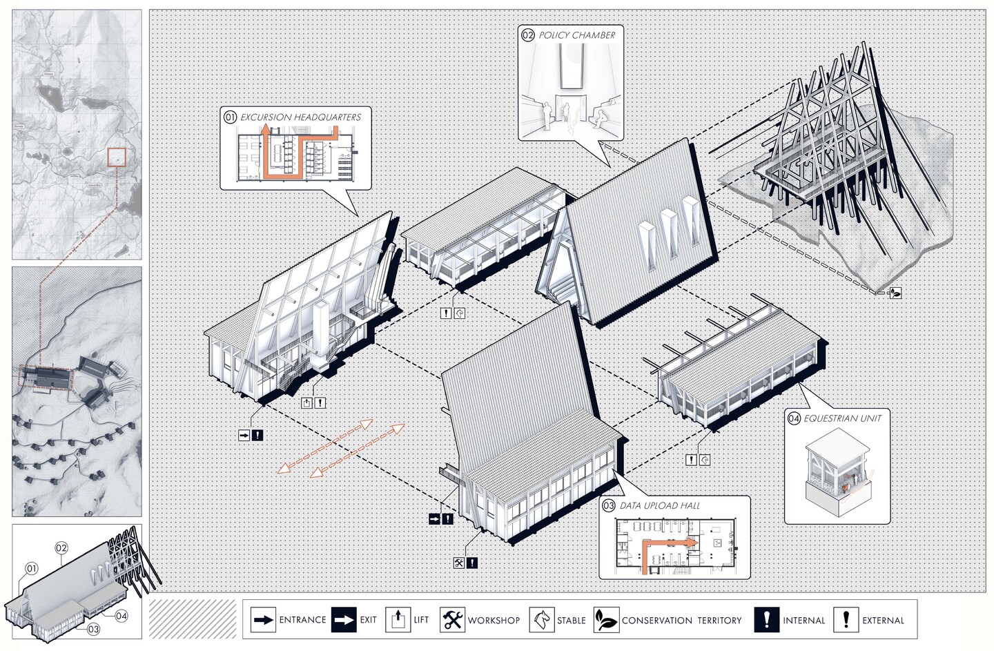
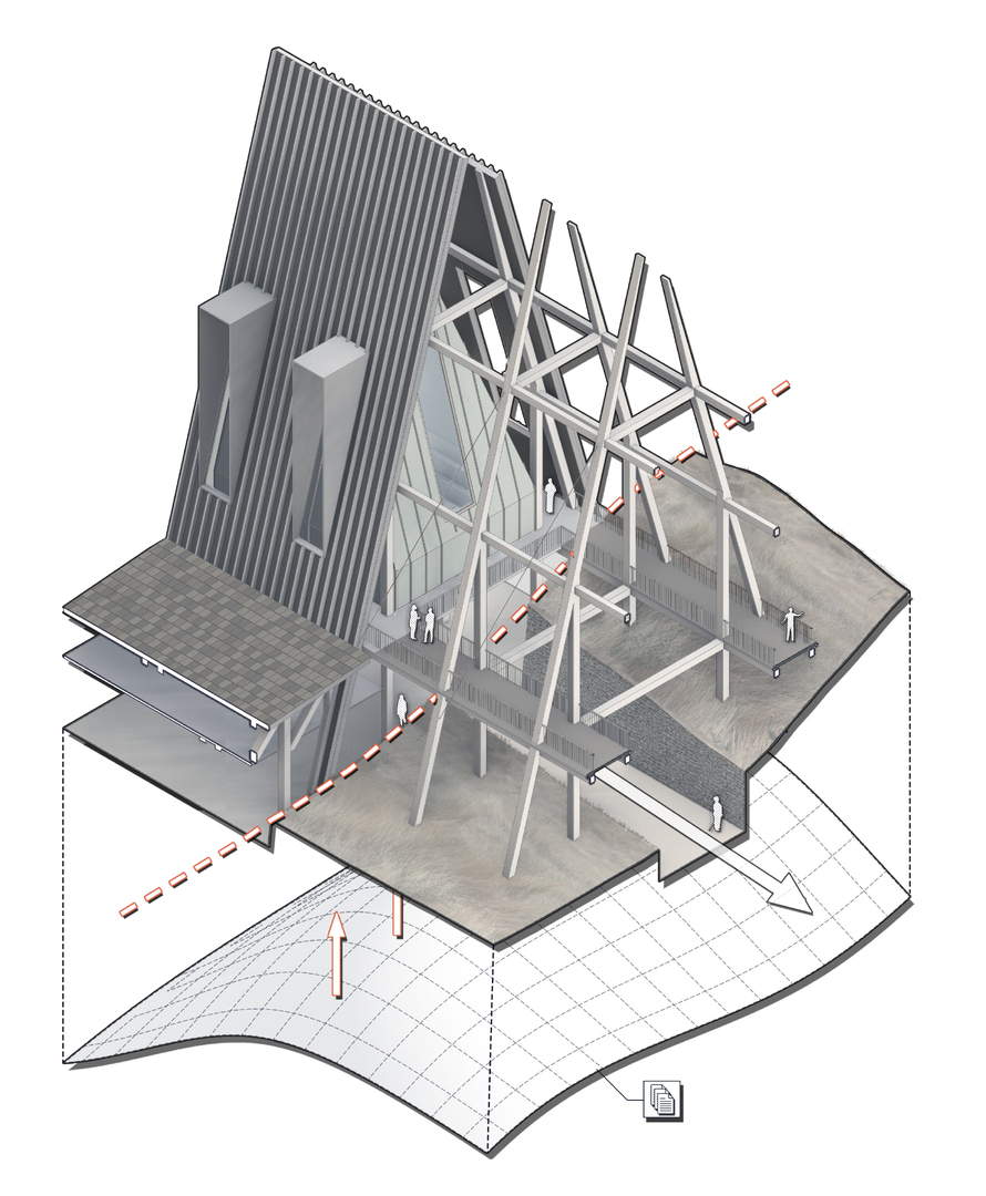
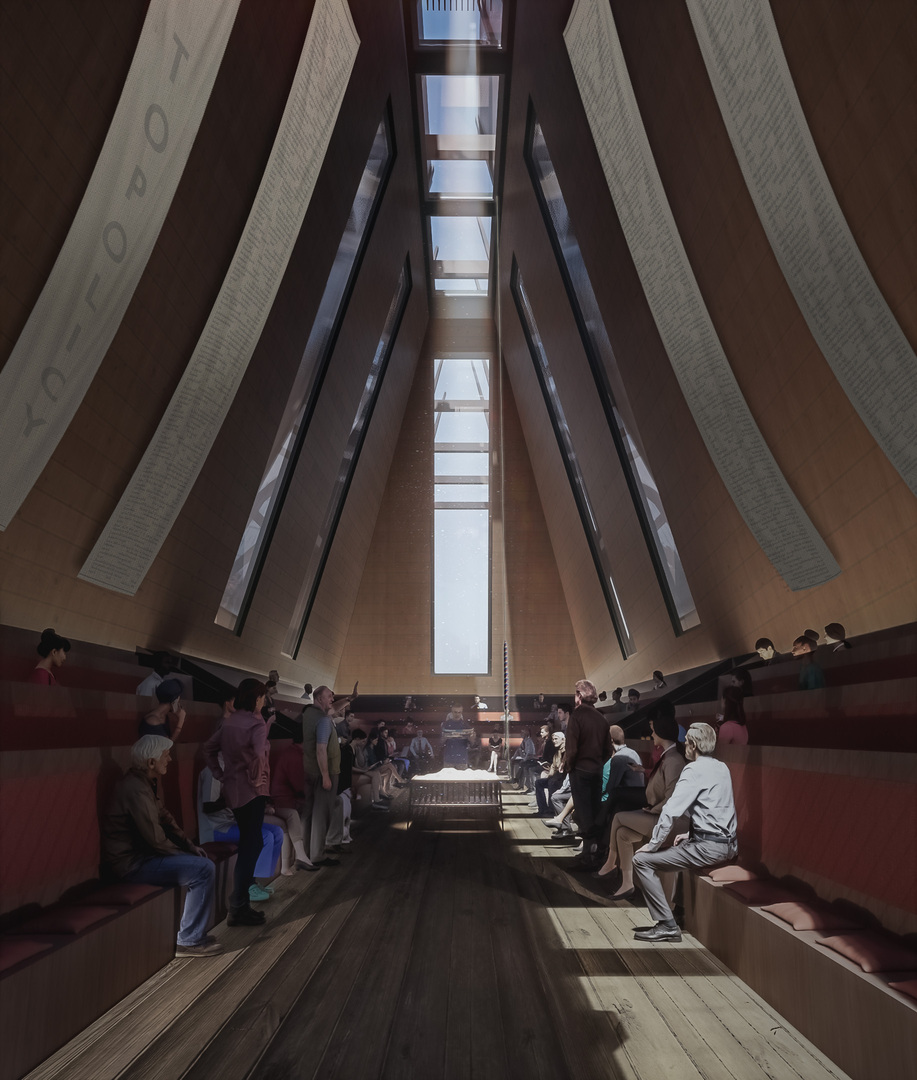
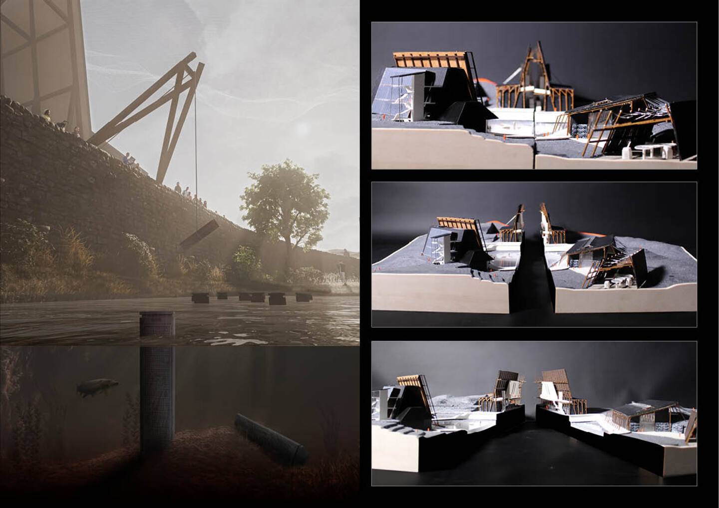
Taking both the Topo-licy methods and the master planning tool, the project tested the system through an architectural intervention. By exploring how the built environment may interact with the masterplan, proposed conservation territory and the new policy framework. These architectural responses consist of three distinct elements that form a co-dependant relationship throughout the scheme. The first element was directed by the masterplan, in this case healthcare, and revolved around mental health support using democratic therapeutic communities (DTC). The second element of the scheme was a Biodiversity Archive, responding to the conservation territory, preserving the heritage of local ecology and creating a true representation of conservation policy. The third element of the scheme facilities the crossing of the policy border between conservation and development territories while also housing the connection to policy directly through a policy chamber. This policy chamber allowed the conservation actors to discuss and amend policy using their expense and data in a more direct manor.